
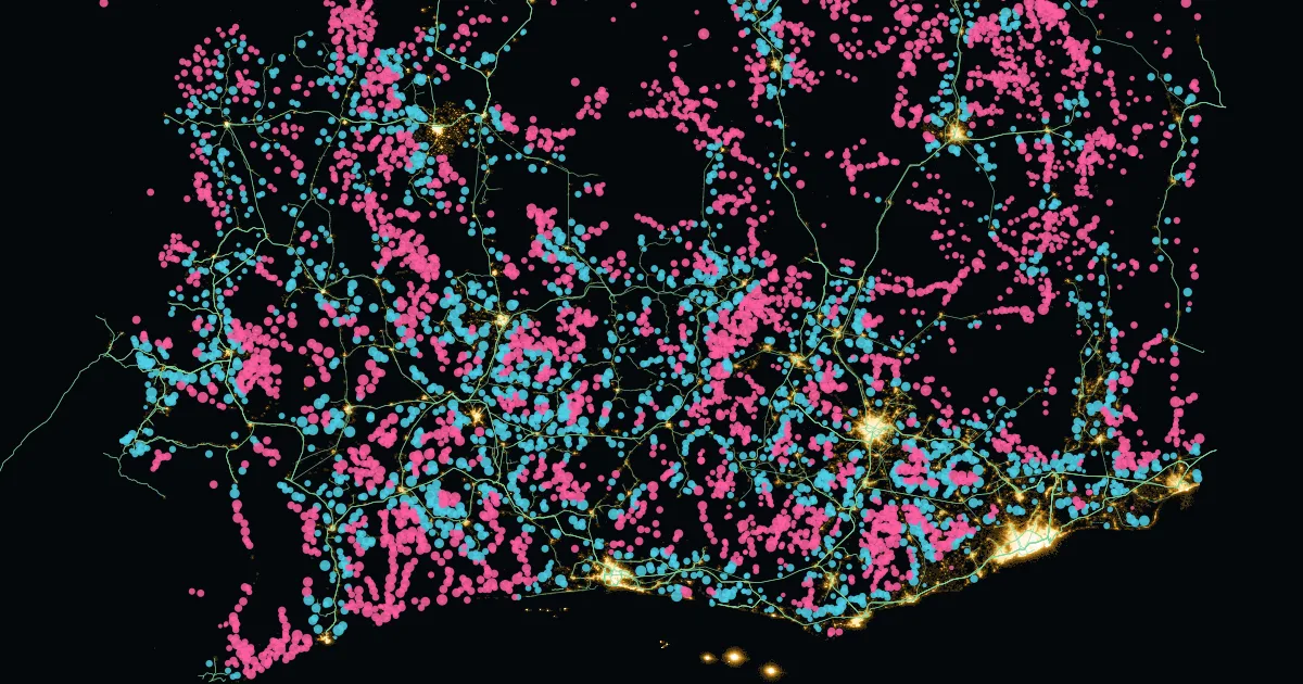
Of about 34,000 places lit at night in 2024, 19,900 (59%) sit 2 km or more from every mapped power line. They are mostly small: together they cover under a quarter of the lit area. Two thirds of them were dark in 2014. About 102 million people live in them or within a kilometer of them.
Every lit place is a place where electricity is used after dark. So either it is served by a line that is not in public data, or its power does not come from the grid at all. Where we can check, it is mostly the first.
How we did it
The new Night lights tab in our grid-edge atlas lays satellite night lights under every mapped line we could find: OpenStreetMap, the lines in our SAPP, EAPP and Madagascar grid atlases, and the World Bank's Africa grid map, plus utility distribution maps for Kenya, West Africa, Uganda, Zambia, Liberia, Mauritania and Kano. We grouped lit pixels into places, set gas flares aside, and measured each place's distance to the nearest mapped line.
We left out predicted lines on purpose. Tools that predict where lines run use night lights as one of their clues, so measuring lights against them would be circular.
Two readings
Where access is high, it is mostly missing data. In Cote d'Ivoire, 2,655 of 3,693 lit places are off the map; in Ghana, 2,322 of 2,879. Both countries have run medium-voltage lines to thousands of villages, and few of those lines are in public data. The blue dots in the picture above are mostly that: villages 2 to 10 km from a line we can see, on a spur we cannot.
Where access is low, more of it is power without the grid. In Chad, 106 of 138 lit places are 10 km or more from any mapped line. In the Central African Republic it is 44 of 53, in Guinea 111 of 217 and in Madagascar 167 of 222. These are more likely mini-grids, mines or towns that run on diesel.
We checked every off-map place against public lists. 468 sit near a mapped mine, 112 near an operating power plant and 61 near a known mini-grid or diesel site. That leaves about 19,250 with no public explanation at all.
Where utilities have published their distribution networks, we can test this. Kenya Power has published its whole network, about 70,000 km of lines from 11 kV up. Before we added it, the method had flagged 1,586 lit places in Kenya as off the map. 95% of them turned out to sit within 2 km of one of those lines. In Zambia and Uganda, it was 78%. Where the full network is public, most off-map lights are on the grid, on lines that were missing from other public data. In countries without published networks we cannot run this check, so the split between the two readings stays uncertain.
Why the data matters
Electrification plans, mini-grid tenders and grid-arrival rules all start from a map of the grid. In many countries, medium- and low-voltage lines are not in public data. Without them, developers, planners and researchers cannot see which villages the grid already reaches. Mini-grids get planned where a line already runs, and places close to the grid are missed. The off-grid power that already works, in mines and diesel towns, rarely shows up in the plans either.
The gap is growing. Off the map, 67% of lit places were dark in 2014. Near mapped lines, it is 54%. New light is appearing fastest where published data is thinnest, so the cost of the missing data rises every year.
What it is not
Light is not a connection. Villages on solar home systems or with low use stay dark, and a grid that is down at night looks dark too. We count a place as lit only if it shows light in at least two of the last three years, and we checked the result against national access rates: for the typical country it comes within about 1 point, while countries with many solar home systems sit below. Part of the growth since 2014 comes from the satellite picking up dimmer light. No site is named on the map. It is a screening view, not a census.
Take a look
Zoom into any of the 39 countries and switch between all lit places and only those newly lit since 2014. The list of every off-map place, with its chance of an unmapped line, is a free download for mappers and utilities.
← All posts · More on the grid edge: the grid-edge atlas